
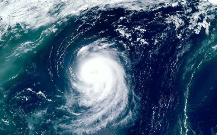
The National Hurricane Center drew a forecast path into Southern California, warning of dangerous surf, rip currents, and possible flooding as Rachel bends north.
Story Highlights
- National Hurricane Center track shows Rachel near the Southern California coast as a post-tropical cyclone.
- Beach hazard and coastal flood advisories are active for San Diego and Orange County.
- An approaching low-pressure system could steer Rachel and boost rain risk.
- Big waves, strong rip currents, and localized flooding pose the clearest threats.
Official Track Shows Rare Post-Tropical Approach To Southern California
The National Hurricane Center said Tropical Storm Rachel would slow, turn, and then accelerate toward Baja California and Southern California, arriving near the coast as a post-tropical cyclone around 96 hours out. The center’s discussion highlighted the unusual track and the potential for impacts even as the system weakens from earlier hurricane strength. Forecasts depicted a close pass with hazards reaching well north into the region’s busy beaches and harbors.
NASA satellite documentation confirmed Rachel was a major hurricane days earlier, with Category 3 winds at 120 miles per hour south of Baja California. That history matters because large, long-period swells and deep tropical moisture can persist even after a storm weakens. Forecasters expected those swells to arrive first, followed by wind and rain chances tied to the storm’s turn and interaction with a broader weather system this weekend.
Active Coastal Alerts Focus On Surf, Rip Currents, And Flooding
National Weather Service products placed Southern California beaches under beach hazards statements and coastal flood advisories. Officials warned of elevated surf, strong rip currents, minor coastal flooding, and erosion in San Diego and Orange County. These alerts covered the Thursday to Saturday window, when swell energy and tides would overlap. Coastal communities, piers, and low-lying roads faced spotty flooding at high tide, with lifeguards bracing for dangerous rescues and pier-area hazards.
Local reports, drawing on federal guidance, flagged the likely hot spots. Orange and San Diego counties stood out for wind and wave exposure, with Long Beach, Catalina Island, Malibu, and Zuma Beach listed for possible flooding during peak tides. Residents and visitors were urged to heed posted warnings, avoid jetties, and respect beach closures. Even experienced swimmers can get trapped in fast rip currents when surf is elevated and shifting with incoming sets.
Steering Trough Could Decide Rainfall And Wind Impacts
Forecast guidance pointed to a low-pressure trough arriving late Sunday into Monday that could tug Rachel’s remnants north. If that interaction lined up, Southern California could see heavier rain bands and gusty winds. If the storm tracked farther south into northern Baja, rain totals would be lower and more scattered. Outlets echoed this setup: weakening system, but with tropical-style hazards, including big waves, rip currents, localized flooding, and periods of rain and wind.
The heat before the storm raised the stakes. A six-day heat wave brought triple-digit readings inland and official warnings, then a planned cooldown with moisture as Rachel neared. Hot, dry ground can shed water fast, which sends runoff into streets and storm drains. That is why forecasters stressed both beach hazards and urban flooding risk, even if totals vary by neighborhood and elevation as the system transitions and bends north.
What Californians Should Do As Conditions Change
Coastal families should check local tide times, move cars off flood-prone streets, and avoid pier areas during peak surf. Boaters should secure lines and plan around changing winds and swell. Inland residents should clear drains and gutters, watch for ponding on roads, and avoid flooded dips or underpasses. Officials cautioned that the system will likely be post-tropical near California, but that change does not reduce surf danger or the chance for short, intense showers and gusts.
Not every day that you see San Diego in a forecast cone! Although Hurricane #Rachel will not be approaching Southern California this weekend at this same intensity, deep tropical moisture associated with the debilitating system will bring a heavy rainfall/flash flood threat to… pic.twitter.com/9LC3g1swzP
— Anthony Duarte (@AnthonyDuarte03) October 8, 2026
Emergency managers urged people to follow trusted alerts and not chase waves for videos. Parents should keep kids off jetties and rock shelves. Drivers should slow down when rain first starts, since oil on hot pavement makes roads slick. This is the conservative, common-sense plan: respect the surf, secure your property, and give first responders room to work. Prepared neighbors help their communities ride out a storm with fewer injuries and losses.
Sources:
nypost.com, rollingout.com, usatoday.com, news.jkn.co.kr, modis.gsfc.nasa.gov, nhc.noaa.gov, weather.gov, ktla.com